Maps and Plans
The files below are in Portable Document Format (PDF). You will need Adobe Acrobat Reader, which is available free from the internet to view the files.
- Project Study Area – Aerial Map – 250′ limits
- Project Study Area – Aerial Map – 500′ limits
- Environmental Constraints Map
- Fixed Bridge Replacement Plan – Preliminary Preferred Alternative (PPA)
- Cross Section of Bridge (existing and proposed)
- Written Description of Bridge Replacement – Preliminary Preferred Alternative (PPA)
- Detour Plan
- Rendering of new bridge – aerial view
- Rendering of new bridge – view from river
Archives
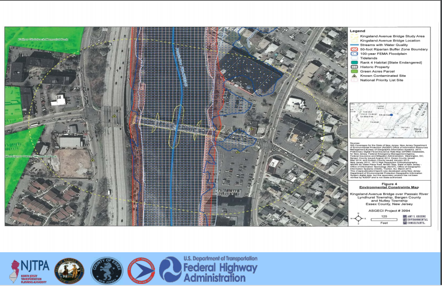
Local Capital Project Delivery Process
Purpose & Need Statement
Data Collection & Environmental Screening Report
Selection of Preliminary Preferred Alternative
Concept Development Report
NEPA Classification
Create Design Communications Report
Initial Public Outreach & Involvement
Approved Design Exception Report
Cost Estimates (Final Design, ROW & Construction)
Approved Environmental Document
Approved Project Plan
Preliminary Engineering Report
Update Design Communications Report
Continued Public Outreach & Involvement
Construction Contract Documents & PS&E Package
Environmental Reevaluations
Environmental Permits
Acquisition of ROW
Update Design Communications Report
Continued Public Outreach & Involvement
Implement and Complete Construction
Continue Public Outreach
As-Builts
Update and Finalize Design Communications Report
Close-out Documentation
Recent News
Thank you to those who were able to attend the Public Information Center (PIC) Meeting No. 1 for the Local Preliminary Engineering (LPE) phase.
Save the Date: Online Public Information Center for the Local Preliminary Engineering (LPE) phase on February 8, 2024.
Community Stakeholders Meeting No. 1 for the LPE phase was held online on Tuesday, April 25, 2023 from 2:00 p.m. to 4:00p.m.